Rand McNally Classic Edition U.S. Wall Map – Paper Rolled
Rand McNally Signature Edition U.S. Wall Map – Laminated Rolled
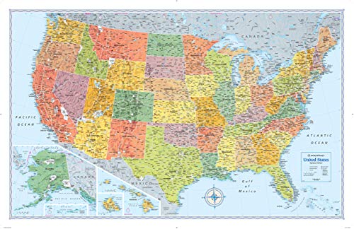
24x36 United States Classic Premier Blue Oceans 3D Wall Map Poster, Folded Paper Edition
US and World Desk Map (13" x 18" Laminated) for Students, Home or Classroom Use by Lighthouse Geographics Office Product
48x78 Huge United States, USA Classic Elite Wall Map Laminated
Craig Frames Wayfarer, Executive United States Push Pin Travel Map
Wall Pops WPE0623 Kids USA Dry Erase Map Decal, Multicolor
National Geographic United States Wall Map - Classic (43.5 x 30.5 in) (National Geographic Reference Map)
Maps International Scratch Off Map Of The US – USA Wall Map – Scratch Off – Detailed cartography - US States - National Parks - 24 x 36
Rand McNally Folded Map: United States
Cavallini Papers & Co Cavallini Vintage USA Map Hanging Poster
National Geographic United States Wall Map - Executive (Poster Size: 36 x 24 in) (National Geographic Reference Map)
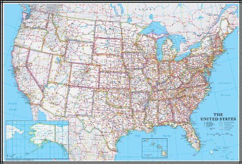
Rand McNally M-Series Full-Color Laminated United States Wall Map, 50 x 32 Inches (RM528960911)
Garmin nvi 55LM GPS Navigators System (Renewed)
24x36 United States, USA Contemporary Premier Wall Map Poster (24x36 LAMINATED)
National Geographic United States Wall Map - Explorer (32 x 20.25 in) (National Geographic Reference Map) Map – April 11, 2019
Maps InternationalClassic USA Wall Map - Map of The USA Poster - Front Lamination – 24 x 36
24x36 United States, USA Classic Elite Wall Map Mural Poster (Paper Folded)
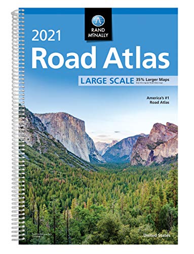
Rand McNally 2021 Large Scale Road Atlas (Rand McNally Road Atlas)
KappaHJ84345 United States Wall Map USA Poster, Home/School/Office
24x36 United States, USA US Executive Wall Map Poster Mural (24x36 LAMINATED)
24x36 United States, USA US Classic Wall Map Poster Mural Laminated
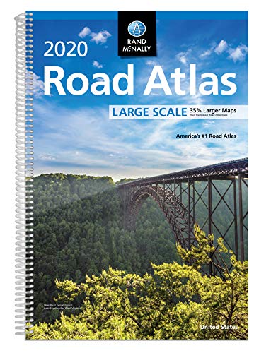
Rand McNally 2020 Large Scale Road Atlas
National Geographic: United States Classic Wall Map - Laminated (43.5 x 30.5 inches) (National Geographic Reference Map)
The United States Push Pin Map 24" x 17" - Unframed Travel Map to Mark Your Travels Around The USA - Multicolored Pushpins Included - Great Travel Gift (Grey)
US Photo Map – 24 x 36 inch United States Travel Memory Map – Personalize with Photos of the States You've Been To - Includes Cutting Stencils and Photo Cropping Website Access
United States Wall Map for Kids | States, Capitals & Pictures | Laminated durable poster 18" x 24" | Perfect for Classroom or Home
USA Photo Map - 50 States Travel Map - 24 x 36 in - Printed on Flexible Vinyl and Rewritable - Includes Secure Photo Maker - Unframed - Gray
Scratch Off Map of United States + All 63 US National Parks Scratch Off Poster, 85 USA Landmarks, Travel Map Kit, 50 State Photo Wall Adventure Maps, Journal Gifts for Travelers by Bright Standards
Amazon Basics Scratch Off Poster of The United States Map with Scratcher and Tracking Accessories,17" x 11.8"
Rand McNally 2020 Large Scale Road Atlas
Ultimate Jumbo United States Wall Map | US Map Poster– USA 50 States 40" x 28" Including All Main Cities
JARLINK Scratch Off USA Map Poster, 12x17 inches United States Map with Unique Accessories Set, Personalized Travel Poster, Gift for Travelers
United States Map with State Flags Poster - Laminated Educational Poster (14x19.5 in) - USA Map for Kids, Elementary Classroom Decorations, Homeschool, and Teacher Supplies
National Parks Map Poster and USA Travel Destinations Poster - Brown Edition (30W x 20H inches)
United State Map Laminated Poster -Double Side Educational Poster For Kids/Adults -18 x 24 inch Waterproof Map For Home Classroom
Map of Fates (Conspiracy of Us)
Novelty Place Scratch off Map of The United States - USA Travel Tracker Map Poster - Flag pins & Complete Scratcher Kit Included - 24" X 17" Large Map - Premium Wall Art Gift for Loved Ones
Palace LearningUSA Map for Kids - LAMINATED - United States Wall Chart Map (18 x 24)
World Map and USA Map for Kids - 2 Poster Set - LAMINATED - Wall Chart Poster of the United States and the World (18 x 24)
Classic United States USA and World Desk Map, 2-Sided Print, 2-Sided Sealed Lamination, Small Poster Size 11.5 x 17.5 inches (1 Desk Map - US Map/Europe CENTERED World Map)
Waypoint Geographic Boardroom Series USA Wall Map, Antique-Style Laminated World Map Poster, Educational Wall Art For Home, Classroom, or Office, Unique Gifts, 24” x 36”
Kids Educational Animal Landmarks World Map Blue Tapestry, Wall Home Decor Art for Nursery, 60x50
USA Map for Kids - United States Wall/Desk Map (18" x 26" Laminated)
US Map w/ Scratch Off Ink by VespucciWorld (24x17" Glossy Laminated) Beautiful Wall Poster to Show Off Your United States Travel Destinations - Unique Accessories Set & 54 USA Landmarks Ebook
Close Up XXL Poster USA Map Premium - Giant America Map with all States - Wall art - Size 55" x 39" MAPS IN MINUTES
Miss Wood Push Pin United States Travel Map Kit Includes: Cork US Map, State Flags and Travel Stickers, for Travelers (XL (23.6 x 35.4 inches), Old School)
Rand McNally State Map Connecticut / Rhode Island: Easy to read!
Utah National Parks (Map Pack) (National Geographic Trails Illustrated Topographic Map)
History of the World Map by Map Hardcover
Yosemite National Park Adventure Set: Map & Naturalist Guide
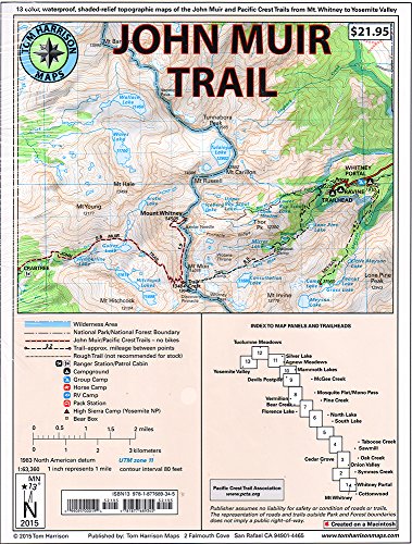
Map-pack of the John Muir Trail
National Geographic Kids U.S. Atlas 2020
US, Rocky Mountains Map (National Geographic Adventure Map, 3120) Map – Folded Map, 1 Jan. 2020
United States Classic, poster size, tubed: Wall Maps U.S. (National Geographic Reference Map)
America the Beautiful: National Parks Quarters Collector's Map 2010-2021: Including the District of Columbia and the Us Territories Hardcover – 31 Aug. 2013
Michelin USA West, Canada West (Michelin Maps)
United States Executive, Poster Size, Tubed: Wall Maps U.S. (National Geographic Reference Map)
U.S. Army Map Reading and Land Navigation: Official Updated 2011 FM 3-25.26 - (Not Obsolete 2001 Edition) - 8.5 x 11 inch Size - 287 Pages - (Prepper Survival Army)
The Official US Army Map Reading and Land Navigation Handbook - Large Format: Find Your Way in the Wilderness - Never be Lost Again! Giant 8.5" x 11" ... 3-25.26, FM 21-26) (Carlile Military Library)
United States Explorer, Laminated - Reference Map: Wall Maps U.S. (National Geographic Reference Map) Map – 2 Aug. 2012
Lonely Planet USA Planning Map
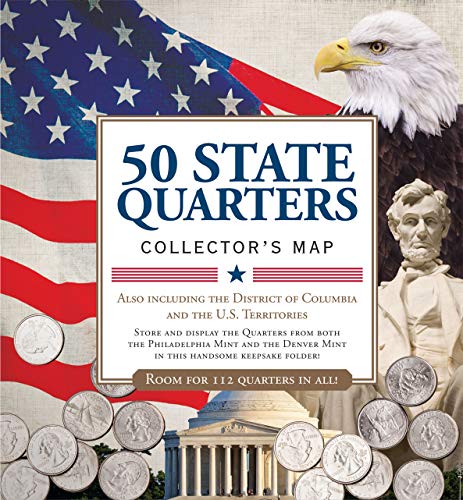
50 State Quarters Collector's Map: Including the District of Columbia and the Us Territories
USA Political - Michelin rolled & tubed wall map Encapsulated: Wall Map (Michelin Wall Maps)
Rand McNally Easy To Read! New Hampshire/ Vermont State Map
Rand McNally Western United States Regional Map
National Geographic Complete National Parks of the United States: Featuring 400+ Parks, Monuments, Battlefields, Historic Sites, Scenic Trails, Recreation Areas and Seashores
US, Great Lakes Map: North America (National Geographic Adventure Travel Map, 3124)
Battlefields of the Civil War Map
Michelin USA: Southeast Map 584
USA - Michelin National Map 761: Map (Michelin National Maps, 761) Map – Folded Map, 9 Jan. 2012
USA Marco Polo Map (Marco Polo Maps)
Scratch Off Map of The World – Deluxe Travel Map with US States and Country Flags, Full Accessories Set, Most Vibrant Colors, Tracks Where You Have Been, Perfect Gift for Travelers, by Earthabitats
Close Up XXL USA Map Premium Poster - Giant America Map with all States 55" x 39" MAPS IN MINUTES
USA West Marco Polo Map (Marco Polo Maps): Pacific Coast, Sierra Nevada, Rocky Mountains
GB eye World Maps USA 61 x 91.5cm Maxi Poster